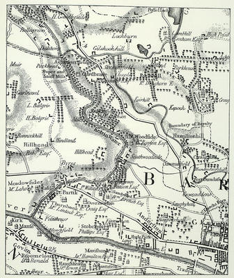
Detail of a map by Thomas Richardson, 1795, showing lands to the west of the city, from Dawsholm, Lambhill and High Possil in the north to Govan and Anderston in the south. The River Clyde, the Forth and Clyde Canal and the River Kelvin are the most prominent natural features on the landscape.
It is clear from the map that, even in 1795, the west end of the city remained largely within the natural boundary set by the St Enoch's Burn, and the industries developing along the course of the rivers and canal were operating in rural surroundings.
Reference: Sp Coll Mu Add. q17
Glasgow University Library, Special Collections
Keywords:
burns, Forth and Clyde Canal, Maps, River Clyde, River Kelvin, St Enoch's Burn, streams, West End
You have 0 images in your photo album.