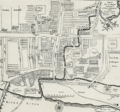
A map showing the area bounded by the Old College of the University of Glasgow and the River Clyde, Stockwell Street and Glasgow Green in 1764. Many streets, closes and markets are named. It is believed to have been produced by surveyor James Barrie for the Town Council and is the earliest surviving map on a detailed scale. Several versions of the map have appeared in various publications over the years.
The map arose from a court action. The Town Council had received complaints about the state of the Molendinar Burn and the dam at the sawmill belonging to timber merchant William Fleming. The magistrates revoked the lease for the sawmill and ground in 1764 and had the mill demolished, and Fleming sued the Town Council for his losses. The final judgement in the court case was made in 1768, when the Council was ordered to pay substantial damages to the timber merchant.
Reference: Mitchell Library, GC 941.435 REN
Reproduced with the permission of Glasgow City Council, Libraries Information and Learning
Keywords:
dams, Glasgow Green, maps, Molendinar Burn, parks, sawmills, surveyors, timber merchants
You have 0 images in your photo album.