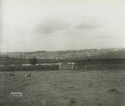
New Corporation houses at High Knightswood from the north-east in 1925. In the foreground are Westerton Station and the Forth and Clyde Canal.
Most tenants who moved to areas such as Knightswood from the inner city enjoyed the benefits of suburban life. Children in particular benefitted from the fresh air, play areas, relative absence of traffic danger, and reduced exposure to the seamier side of city life. There was a reported improvement in children's appetites, leading to increased food consumption and an increase in average height and weight.
At the beginning of the 21st century the canal still marks the boundary between Glasgow and East Dunbartonshire. It was closed to navigation on 1 January 1963, but was re-opened as part of the Millennium Project. It is owned and operated by British Waterways.
Reference: OPW 76/30/2
Reproduced with the permission of Glasgow City Council, Libraries Information and Learning
Keywords:
British Waterways, canals, children, council houses, Forth and Clyde Canal, Glasgow Corporation, housing estates, housing schemes, Millennium Project, railway stations, railways, Westerton Station
You have 0 images in your photo album.