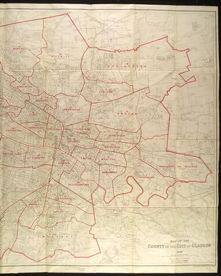
This map was issued by John Bartholomew & Son to accompany the Post Office Glasgow directory for 1926-1927. This is the eastern section.
Bartholomew took over production of the annual Post Office directory map in 1865, basing it on the Ordnance Survey map. The 1926 map has munucipal ward boundaries superimposed in red, along with names and numbers of the wards. The map is divided into half mile squares.
A major extension of the city boundary took place in 1926, bringing in areas such as Robroyston, Millerston, Carntyne, Lambhill and Aikenhead. The purpose of this extension was not so much to incorporate existing suburbs as to provide land on which Corporation housing could be built.
Reference: Mitchell Library, GC 912 (1926)
Reproduced with the permission of Glasgow City Council, Libraries Information and Learning
Keywords:
city boundary, Glasgow Corporation, John Bartholomew & Son, maps, municipal wards, Ordnance Survey, Post Office Glasgow directory
You have 0 images in your photo album.