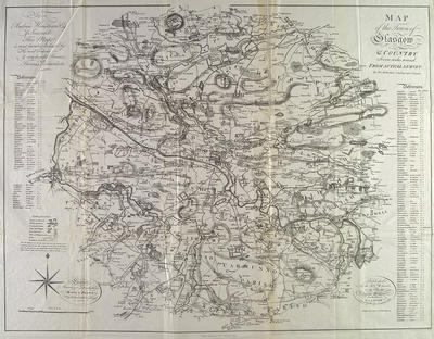
Surveyor Thomas Richardson's "Map of the town of Glasgow and country seven miles around" shows the city in the context of its surrounding area in 1795. The map covers the area lying between Kirkintilloch and East Kilbride; Paisley and Bothwell. The small scale allows little detail for features in Glasgow.
An alphabetical list of estates with owners is given in the margins, with distances of estates from Glasgow Cross. The top left corner has a dedication to Andrew Houston Esq. of Jordanhill.
Andrew Houston was a son of Alexander Houston, founder of the firm of Alexander Houston & Co which played a leading role in Glasgow's trade with the West Indies. The family's country house was at Jordanhill. The collapse of Alexander Houston & Co in 1795 was the biggest business failure in Glasgow during the 18th century.
Reference: Mitchell Library, GC 941.435 REI
Reproduced with the permission of Glasgow City Council, Libraries Information and Learning
Keywords:
Alexander Houston & Co, business failures, estates, landowners, maps, merchants, surveyors
You have 0 images in your photo album.