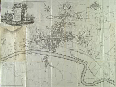
John McArthur's "Plan of the City of Glasgow, Gorbells and Caltoun" of 1778 is the most detailed of the early maps of the city. It covers an area from Anderston to the lands of Barrowfield, and from Little Govan to the Barony Glebe. Major buildings are shown individually in plan form, and the owners of the more sizeable properties are named. A good impression is given of the closes and back-land development within the city, while the surrounding country has fields, parks and land ownership shown.
Alexander Baillie and James Lumsden engraved the plan. On the strength of this work, McArthur, a local surveyor and teacher of mathematics, was elected a burgess and guild brother of the city in February 1779. His case could not have been harmed by his dedication of the map to the "Lord Provost, Baillies, Dean of Guild and Convenor with the Counsellors of the City of Glasgow".
Reference: Mitchell Library, GC 941.435 REI
Reproduced with the permission of Glasgow City Council, Libraries Information and Learning
Keywords:
backlands, closes, landowners, maps, surveyors, teachers
You have 0 images in your photo album.