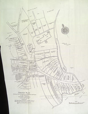
City Engineer A B McDonald produced this Sketch plan showing sites of principal buildings and places in the vicinity of Glasgow Cathedral in the 16th century to illustrate volume XI of Protocols of the Town Clerks of Glasgow in 1900. The figures denote the numbers of the writs in the volume in which the respective properties are described.
The Cathedral and Bishop's Castle are shown in some detail, and 16th century landowners are identified. Once the initial confusion is overcome, of seeing streets in 1900 underprinted on a map of the 16th century city, the exact location of the 16th century properties can be seen clearly.
Reference: Mitchell Library, GC 941.435 REN
Reproduced with the permission of Glasgow City Council, Libraries Information and Learning
Keywords:
Bishop's Castle, Bishop's Palace, Glasgow Cathedral, landowners, maps, Protocols of the Town Clerks of Glasgow
You have 0 images in your photo album.