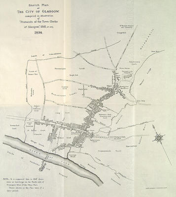
This map, which claims to represent the city as it was in 1547, was produced by lithographers Robert Gardner & Co in 1894 to illustrate the book Protocols of the Town Clerks of Glasgow.
The principal streets and buildings are named and land owners shown. A notable qualification is included: "It is supposed that in 1547 there were no buildings on the north side of Trongait, west of the West Port. Those shown on the plan were of a later period."
Reference: Mitchell Library, GC 941.435 REN
Reproduced with the permission of Glasgow City Council, Libraries Information and Learning
Keywords:
landowners, maps, Protocols of the Town Clerks of Glasgow, Robert Gardner & Co
You have 0 images in your photo album.