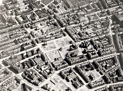
An aerial photograph of Calton looking east, October 1932. Large-scale demolition work was underway, and there are large gap sites in the area lying between Gallowgate (at the bottom left corner of the photograph) and London Road (the road which cuts across the top right corner). Part of the route of the North British Railway Co's branch line from College Station to Bridgeton Cross via Gallowgate Central (opened 1892) can be followed on the left, where it crosses under Gallowgate and other Calton streets on its way south-east.
Calton had some of Glasgow's worst housing. The implementation of the Calton Improvement Scheme during the 1930s resulted in the demolition of 1,280 dwellings on old streets and in the area's notorious backlands. New tenements (containing just 282 homes) were erected in their place, and several streets were re-aligned.
Reference: 143.80.24
Reproduced with the permission of Glasgow City Council, Glasgow Museums
Keywords:
aerial views, backlands, Calton Improvement Scheme, North British Railway, railways, slum clearance, slums, urban regeneration
You have 1 image in your photo album.