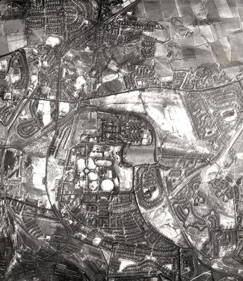
An aerial photograph showing Springburn Park and the surrounding area. It was taken by the RAF in the 1950s with snow highlighting the open ground.
Bishopbriggs appears at the top left of the image, with the Kirkintilloch Road running through it to join the Springburn Road at Auchinairn Road in Colston. To the south of Auchinairn Road are Stobhill General Hospital and Springburn Park, the latter laid out on farmland acquired by the Corporation in 1892 and with its paths and other features clearly outlined in the snow. Traces of rig and furrow can be seen on Littlehill golf course, to the east of the hospital, revealing that the area was once farmland. The growth of Bishopbriggs resulted in the construction of houses on the fields at the top right corner of the photograph.
To the south of Springburn Park are Balornock and (bottom left) Cowlairs' and Springburn's busy locomotive works and railway sidings are prominent.
Reference: 742
Crown copyright is reproduced with the permission of the Controller of Her Majesty's Stationery Office
Keywords:
aerial views, fields, golf courses, hospitals, Littlehill Golf Course, locomotive works, parks, RAF, railway lines, railway sidings, rig and furrow, roads, Royal Air Force, snow, Springburn Park, Stobhill General Hospital, tenements
You have 26 images in your photo album.