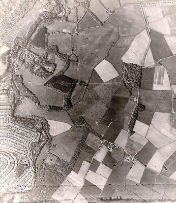
An aerial photograph showing Linn Park and the surrounding areas, taken in May 1946 by the RAF.
The Carmunnock Road runs from north to south through fields to the right of the photograph. Netherlee lies in the bottom left hand corner, separated from Linn Park to the north and fields to the east by the River Cart. There are only fields where the housing estates at Simshill, Linndale and Howgill were subsequently built on the west side of Carmunock Road, and Castlemilk to the east.
Linn Park is the second largest park in Glasgow (Pollok Park is the largest), covering 212 acres. It was acquired by Glasgow Corporation in 1919. Linn Park and the Castlemilk estate were brought within the city boundaries in 1938.
Reference: 1986
Crown copyright is reproduced with the permission of the Controller of Her Majesty's Stationery Office
Keywords:
aerial views, fields, housing estates, housing schemes, Linn Park, parks, RAF, River Cart, rivers, Royal Air Force, White Cart Water
You have 1 image in your photo album.